Services
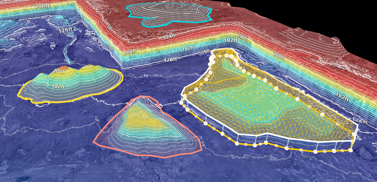
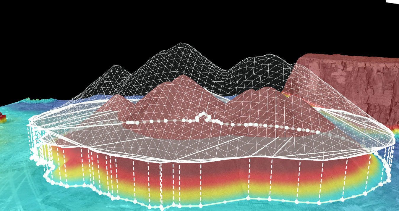
Volume Measurements
Using state-of-the-art technology and industry-leading expertise, we offer precise and detailed volume calculations for various applications.
Whether you require stockpile volume assessments, terrain modeling, or volumetric analysis for infrastructure development, our advanced technical aerial solutions will provide you with valuable insights to support informed decision-making and project planning. Trust us to deliver reliable and efficient volume measurements that drive the success of your operations.
Experience our unparalleled services designed to elevate your projects.

Windmill Inspections
Our team is well-versed in conducting thorough aerial surveys of wind turbines, assessing their structural integrity and identifying any potential issues with utmost accuracy. By employing advanced technical methods, we capture detailed data from all angles, providing our clients with valuable insights to optimize maintenance strategies and maximize operational efficiency. The use of drones for windmill inspections offers a host of advantages in terms of efficiency, data quality, and, most importantly, safety.
Elevate Your Energy Success with Precision Aerial Inspections.
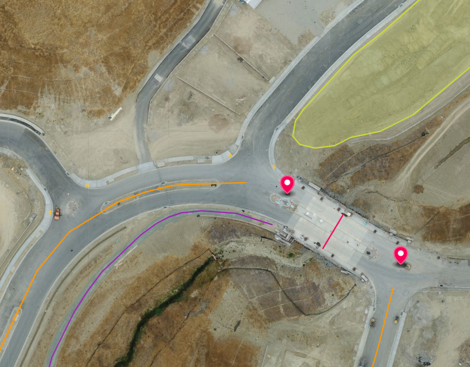
Progress Reporting
Facilitated through the use of cutting-edge technology - our Advanced Drones equipped with RTK photogrammetry capabilities have been diligently surveying and mapping the construction site to provide real-time insights and Accurate Data Collection, Progress Assessment, Enhanced Efficiency on the project's progress.
Our UAV services enables efficient construction site monitoring, reducing costs and time. Precision aerial data cuts labor needs, streamlines reporting for faster decision-making in the construction industry.
Skybound precision, seamless reporting.

Advanced 3D Data Analysis
The ability to generate high-resolution 3D models allows for precise measurements and in-depth analysis of topographical features, buildings, or infrastructure. This leads to more informed decision-making in various industries, from urban planning to construction. Additionally, the efficiency of drone surveys reduces time and costs compared to traditional methods, making 3D drone reconstructions a valuable asset for projects requiring timely data collection and comprehensive insights. Partner with us for professional advanced technical solutions that elevate your mapping and surveying needs.